
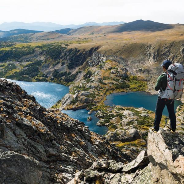
This month's walk: Helm Crag and the Lion and the Lamb
Written by George Fisher
Wednesday, 17 February, 2021

We’ve linked up with carfreewalks.org, the website for people who love walking but want to reduce their impact on the environment, to bring you this great walk.
Get active outdoors with Britain on Foot
Britain on Foot is an initiative with one clear objective; to encourage more people in Great Britain to get active outdoors. It’s all about getting fitter, healthier and happier! This could mean walking to work, hillwalking, geocaching with the family, trail running or even mountaineering.
Take a quick look at the Britain on Foot website britainonfoot.co.uk where you can upload your own activity and share your experiences with thousands of other like-minded individuals. It’s a socially interactive, community-led site that’s continually updated. So take your first step and sign up today!
This month's walk: Helm Crag and the Lion and the Lamb
To celebrate the re-opening of the A591, the central route through the Lakes linking Keswick with Ambleside that was devastated by last year’s exceptional flooding, we’re featuring a walk that will take you across the new section of road at Dunmail Raise and down to Grasmere to start.
This is a circular, half-day walk on lower hills and fells (below 600m) from Grasmere village, visiting one of the most recognisable landmarks in the Lake District: the 'Lion and the Lamb' rock formations on the summit of Helm Crag.
Loop or linear? Loop
Map: OS Explorer OL7 - The English Lakes (SE area), OL5 - The English Lakes (NE area), OL4 - The English Lakes (NW area)
Total distance: 11km (6.8 miles)
Total height gain: 1,115m (3,660ft)
Start and Finish: Grasmere, OS Grid: NY337074
Unsuitable for: younger children, buggies, wheelchairs
Public transport: the 555 bus service links Keswick with Ambleside on the A591
1. Grasmere OS Grid: NY336074
From Grasmere, follow the Easedale Road heading northwest until you reach the small hamlet of Easedale.
2. Easedale OS Grid: NY327084
About 1.4 km (roughly 0.9 miles) from 1
From Easedale, take the footpath which zigzags up past White Crag. Be warned - it's a steep one!
3. Helm Crag OS Grid: NY325094
About 1 km (roughly 0.6 miles) from 2
First summit - Helm Crag. From here, follow the ridge in a northwest direction towards Gibson Knott, and carry on until you reach Calf Crag. The land around here is all National Trust owned.
4. Calf Crag OS Grid: NY303105
About 2.5 km (roughly 1.5 miles) from 3
At Calf Crag, the ridge widens into a plateau. Take a bearing and head for Steel Fell. On a clear day you will get a great view of Thirlmere Reservoir. Follow the path off Steel Fell towards Helmside.
5. Helmside OS Grid: NY332095
About 3 km (roughly 1.9 miles) from 4
From Helmside, follow the road heading south back to Grasmere (sorry no footpaths here). Enjoy a nice cup of tea in Grasmere, and maybe a slice of cake.
6. Grasmere OS Grid: NY338075
About 2.1 km (roughly 1.3 miles) from 5
Back to Grasmere, where the 555 bus heads north or south through the Lakes.


Get 10% OFF Your First Order!
Sign up to our newsletter today and get 10% off your first order online (not available instore). Excludes Sale/Promotional items, Gift Vouchers, Watersports, Electronics, Arcteryx, Hilleberg, Dryrobe, Thule, Wahoo, Garmin & Norrona. Terms and conditions apply.
Use code 10OFF
Thanks for signing up! Enter code 10OFF to get your discount at checkout!