

Night Navigation
Written by George Fisher
Wednesday, 17 February, 2021

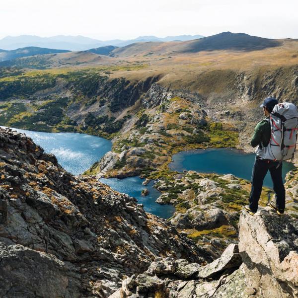
As the nights draw in, our days on the hill tend to be cut short. However, the impending darkness need not force you off the fells. Developing your navigation skills so that you are confident at night can be a tremendously rewarding experience. It opens up a range of options, including rising early to gain a mountaintop sunrise, a through-the-night running challenge, or preparing you for an early start on an alpine mountaineering holiday. It also gives you a ‘get out of jail free card’ in the event of finishing a walk late.
A common motivator for improving ‘night nav’ is to gain your Summer Mountain Leader qualification. On the course, night nav is notoriously stringent and often a cause for people to be deferred or to fail their assessment. Building up to this standard of navigation can be a real obstacle for many, but here are a few ideas on how you can make some leaps forward.
Location
You need to find a good location to practise night nav. This needs to have a range of features to navigate between, ideally using different techniques; wall junctions, trig points, cairns, sheepfolds and woods. Anything marked on a map, or you know the exact location of, can be used. The area doesn’t need to be big; a square mile or two is ideal. The exercise isn’t about covering ground; you want to be spending time practicing techniques, not walking. Make sure you have the right of access, as some landowners (particularly on grouse moors) don’t appreciate unidentified people on the fell at night.
Technique
With fewer features to observe in the dark, you will need techniques such as compass bearings, pacing and timing to establish your direction of travel and distance covered. Work on these techniques during the day and try to make them your primary method of navigating. Learning how many paces you take per hundred metres, and how this varies depending on the terrain and the weight of your pack, is a key skill to master in daylight before you apply it in the dark.
Comfort zone
If you are a bit nervous, or are unsure of your skill level, then a location that you know well in daytime can be an ideal trial run. This should mean that you are within your comfort zone and you are likely to recognise the various features when you find them. Even your local park can be a useful place to practice; just make sure you don’t make it too easy!
Catching features and safety
If your practice area can be bounded by obvious ‘catching features’ like fence lines, this ensures you can’t go too far wrong. Roads are great as they can also give you an easy way of returning to your start point if you get disorientated. It’s also best to choose an area with very few hazards. If you’re not confident of knowing exactly where you are then cliffs and broken ground are best avoided early on, so find an area that is a bit more rolling, with no steep drops.
Buddy up
Having a friend to practice with can be useful and aid your confidence. Whether you’re at a similar level and work together to find the various features, or they are using their greater experience to mentor you, it can make the experience more fun and give you some extra safety if needed. If you’re on your own, tell someone specifically where you have gone and when you plan to return.
Head torch
There are various items of equipment that can add to the experience. A good head torch is an obvious must; the brightness of modern designs like the ones we stock from Petzl would be considered cheating by mountaineers of the past, but it makes a huge difference on the hill. Have a read of our ‘Shining a Light on Head Torches’ blog to see which one is best for you.
Compass
A compass that is easy to read at night is also important. A reflective bezel and north arrow make it much easier, as well as a Romer scale for accurate grid references. The Silva Expedition compass is ideal as it has clear luminous markings and a base plate that is easy to hold with gloves. All Silva compasses come with an leaflet on how to navigate, which is handy when practicing.
GPS
Having some kind of back-up is also useful for navigating, particularly at night when you can be close to your chosen feature but struggle to confirm you have arrived. A GPS device is a great way of checking and can be used to test how accurate you are with map and compass; we stock Garmin and Satmap.
Handy tips
When pacing, it can be very easy to lose count and forget how far you are into that leg of the journey. Stringing some cordlocks on to a piece of cord and attaching this to your rucksack strap makes an ideal recording device. Simply slide a cordlock from one end of the cord to the other every hundred metres, and this should help you to keep count. It can also be useful to create a ‘pacing card’; a small, pocket-sized card with your known paces for covering a 100m distance over different terrains. You can refer to this on the hill to predict how long it will take you to cover the ground ahead.
Finally, finishing your route at a nice pub with a roaring fire is a great motivator to get you round your chosen route!
Learning from someone with lots of experience is often a fast way to pick up the skills you need. At George Fisher we run Navigation and Mountain Safety sessions, and our training partners run courses up to an advanced level.


Get 10% OFF Your First Order!
Sign up to our newsletter today and get 10% off your first order online (not available instore). Excludes Sale/Promotional items, Gift Vouchers, Watersports, Electronics, Arcteryx, Hilleberg, Dryrobe, Thule, Wahoo, Garmin & Norrona. Terms and conditions apply.
Use code 10OFF
Thanks for signing up! Enter code 10OFF to get your discount at checkout!